 Biodiversity

- Himalayan
Mountains - Northern
Plains - Peninsular
Plateau - Deserts
- Coastal
Plains - Islands
- Tropical Wet
Evergreen Forests - Tropical Deciduous
Forests and Scrubs - Montane
Forests - Alpine
Forests
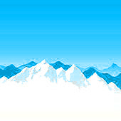
The Himalayas, extending over 2500 km, cover the northern border of India. It is divided into Western, Central and Eastern Himalayas.
The Western Himalayas are located in the states of Jammu and Kashmir, and Himachal Pradesh. Nepal and the Indian state of Uttarakhand house the Central Himalayas.
The Eastern Himalayas cover northern parts of the West Bengal and extend into Sikkim, Bhutan and Arunachal Pradesh.
Himadri, Himachal and Shivaliks are the three parallel mountains ranges of Himalayas.
The Himadri range, also known as the Greater Himalayas is the northern most range.
The world's highest mountain peak, Mount Everest (8848 metres) in Nepal, belongs to the Greater Himalayas.
Kanchenjunga (8598 metres), Nanga Parbat (8126 metres) and Nanda Devi (7817 metres) are the highest peaks of the Greater Himalayas in India.
The Himachal range, also known as the Middle or the Lesser Himalayas lie on the south of the Himadri.
Jelep La, Shipki La, Nathu La and Bomdi La etc. are some of the important passes in the Himalayas.
Poorvanchal mountains are located on the north-eastern side of India. They consist of the Patkai Bum and the Naga Hills in the north; Mizo and Lushai Hills in the south, and the Garo, Khasi and Jaintia Hills in the centre.
The Northern Plains have been formed due to the interplay of the three major river systems- the Indus, the Ganga, and the Brahmaputra along with their tributaries.
These Plain are made up of the rich alluvial soil. The Northern Plains are agriculturally productive as they have adequate water supply and favourable climate.
The Punjab Plains (Indus), the Ganga Plains and the Brahmaputra Plains together form the Northern Plains.
The Punjab Plains are formed by the Indus and its tributaries.
Ganga Plains are found in the states of Haryana, Delhi, Uttar Pradesh, Bihar, parts of Jharkhand and West Bengal.
Brahmaputra Plains are located in Assam.
The Peninsular Plateau lies to the south of the Northern Plains. It has broad and shallow valleys and rounded hills and is made up of black soil called the Deccan Trap. Central Highlands and the Deccan Plateau are two distinct parts of this plateau.
The Malwa Plateau, Bundelkhand, Baghelkhand, and the Chotanagpur Plateau form a part of the Central Highland.
The Deccan Trap, Western Ghats, Eastern Ghats, and the North-East extension form a part of the Deccan Plateau.
Malwa plateau lies in Madhya Pradesh bounded by the Aravalli hills in the north-west and the Vindhyas in the south.
Bundelkhand lies along the borders of Uttar Pradesh and Madhya Pradesh.
The Malwa Plateau covers western Madhya Pradesh and south-eastern Rajasthan with Gujarat in the west.
Chotanagpur Plateau covers Jharkhand, parts of Chhattisgarh, and West Bengal. It is the richest mineral producing region of India.
The Western Ghats and the Eastern Ghats mark the western and eastern edges of the Deccan Plateau. Western Ghats lie parallel to the western coast and are continuous.
The Sahyadri, the Nilgiri, the Annamalai, the Cardamom Hills, the Annamalai, and the Cadamom Hills form the western edge of the plateau.
Anaimudi peak in Kerala is the highest peak of the Peninsular India, at 2695 metres above the sea level.
The Western Ghats are higher than the Eastern Ghats. The Eastern ghats are also discontinuous and irregular, and crossed by rivers draining into Bay of Bengal.
The Mahanadi, Godavari, Krishna, and Cauvery rivers of the Deccan Plateau flow from west to east and then merge into the Bay of Bengal.
Narmada and Tapti rivers of the Deccan Plateau, flow from east to west and fall in the Arabian Sea.
The Western Ghats and the Eastern Ghats meet in the Nilgiri hills.
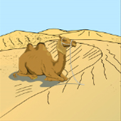
The Indian Desert receives very low rainfall, below 150 mm per year. Luni is the only large river in this region. The Thar Desert, also called the Great Indian Desert, covers more than 77,000 square miles.
The Thar Desert is the 18th largest subtropical Desert in the world.
Thar Desert is the most densely populated Desert in the world.
The Thar region of Rajasthan is the biggest wool-producing area in India.
Kharif crops are the chief source of agricultural production, bajra being the main crop. The other crops include corn, jowar, groundnuts, and sesame etc.
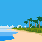
The Coastal area in India lies along the Arabian Sea on the west, and the Bay of Bengal on the east.
The western coastal plains extend from Gujarat in north to Kanyakumari in south, and are located between Western Ghats and Arabian Sea.
The western coastal plains are Narrower and wetter than the eastern coast.
The western coast is divided into the Konkan (Mumbai-Goa, northern part of the coast), the Kannad plain (central stretch), and the Malabar coast (the southern stretch).
Important ports of the western coasts include Mumbai, Marmagoa, Cochin, Mangalore, Nhava-Sheva, and Kandla.
Western Ghats is marked with Lagoons such as Ashtamudi and Vembanad called Kayals in Kerala.
The northern part of the coastal plains along the Bay of Bengal are called Northern Circar, and the southern part is called the Coromandel Coast.
The eastern coastal plain lies between Eastern Ghats and Bay of Bengal from Gangetic delta in north to Kanyakumari in south.
Rivers such as the Mahanadi, the Godavari, the Krishna, and the Kaveri form an extensive delta on the eastern coast. Lake Chilika is an important feature along the eastern coast. The coastal region provide sites for fishing and port activities.
The eastern coastal plains are broader but drier than the western plains.
The Andaman and Nicobar islands in the Bay of Bengal and the Lakshadweep islands in the Arabian Sea are the two group of Islands in India.
The Lakshadweep islands is made up of 27 small coral islands, and lies close to the Malabar cost of Kerala.
The Andaman and Nicobar islands are located in in the Bay of Bengal. The Andaman lie in the north, while the Nicobar in the south.
Andaman is a group of 204 small islands, while the Nicobar islands is a group of 19 islands. Located close to equator, these islands experience equatorial climate and have thick forests.

Tropical Wet Evergreen forests are classified into wet evergreens, semi-evergreen, moist deciduous, littoral and swamp.
These forests remain warm and wet throughout the year.
They receive heavy rainfall, sometimes more than 200 cm. They are also called tropical rain forests.
They are called evergreen, as they appear green all the year round and don’t shed leaves.
These forests are located on the eastern and western slopes of the Western Ghats, covering states of Tamil Nadu, Karnataka, Kerala and Maharashtra. Tropical Wet Evergreen forests also found in Assam, Arunachal Pradesh, Meghalaya, Nagaland, Tripura, West Bengal, and Andaman & Nicobar Islands.
The one horned rhinoceros are found in the jungles of Assam, and West Bengal.
Wet evergreen forests are found in the south along the Western Ghats and the Nicobar and Andaman Islands and all along the north-eastern region. Trees common in these forests are jackfruit, betel nut palm, jamun, mango, and hollock.
Moist deciduous forests are found throughout India except in the western and the north-western regions. Trees common in this region include sal and teak, along with mango, bamboo, and rosewood.
Semi-evergreen forests are found in the Western Ghats, Andaman and Nicobar Islands, and the Eastern Himalayas. They have a mixture of the wet evergreen trees and the moist deciduous tress.
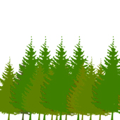
Tropical deciduous forests also called the monsoon forests, are the most widespread forests of India.
These forests remain warm and wet throughout the year.
They receive rainfall between 200 cms and 70 cms.
Trees in these forests shed their leaves for six to eight weeks during summers.
These forests are classified into tropical moist, the dry deciduous and the thorn forests. This classification is done on the basis of the rainfall they receive every year.
Moist deciduous receive rainfall between 200 cms and 100 cms. They are found along the foothills of the Himalayas, Jharkhand, Odhisha, Chhattisgarh, and the Western Ghats.
The dry deciduous forests receive 100 to 70 cm of rainfall. These forests are located in the peninsular plateau and the plains of Bihar and Uttar Pradesh.
The Thorn forests and scrubs receive less than 70 cm of rainfall. They are found in Gujarat, Rajasthan, Madhya Pradesh, and Haryana.
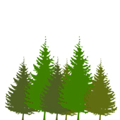
The Montane forests are classified into wet montane, moist montane, dry montane, broad leaved forests, pine montane, and dry ever green. This classification is based on the different altitudes at which they are located in the mountain regions.
The wet montane temperate forests are found between a height of 1000 and 2000 metres. They are found in the regions of Arunachal Pradesh in parts of the Nilgiri Hills.
The moist montane temperate forests are located from the Western Himalayas to the Eastern Himalayas.
The Dry ever green montane forests are found mainly in Lahul, Kinnaur, Sikkim, and other parts of the Himalayas.
Broad leaved forests are located in the Eastern Himalayas and the Western Ghats.
Pine montane forests are located in the Shivalik Hills, Western and Central Himalayas, Khasi, Naga, and Manipur Hills.
Dry ever green forests are found in the Shivalik hills and the Himalayas.
Alpine forests are divided into sub alpine, moist and dry alpines.
Sub alpines are found from Kashmir to Arunachal Pradesh.
Moist Alpines are located along the Himalayas.
Dry Alpines are found in Uttar Pradesh, Himachal Pradesh, Punjab and Kashmir.

Corals are considered to be a separate ecosystem, even though they are located within the ocean.
Most people mistake corals for plants, even though they are animals that are related to jellyfish.
Coral reefs are found all around the world in tropical and subtropical oceans.
Corals can be classified into fringing reefs, barrier reefs and atolls.
Fringing reefs grow in shallow waters.
Barrier reefs grow parallel to coasts, but are separated from land by a lagoon.
Barrier reefs can grow in fairly deep water.
In India, major coral reefs are found in Gulf of Mannar, Gulf of Kachchh, Andaman and Nicobar and Lakshadweep Islands.
Fringing reefs are found in Gulf of Mannar and Palk Bay.
Fringing and barrier reefs are found in Andaman and Nicobar Islands. 579 species of corals have been identified in these islands.
Atoll reefs are found in Lakshadweep.
Estuaries are semi-enclosed coastal bodies, where seawater mixes with freshwater, as they have the sea at one end and a river at the other.
Estuaries are sometimes called bays, lagoons, harbours, or sounds.
The main reasons for the formation of estuaries are rising sea level, movement of sand and sandbars, melting of glacial processes, and tectonic processes.
Most of India’s major estuaries are located on the east coast in the Bay of Bengal. The estuaries on the west coast are smaller, Mandovi and Zuari estuaries are two examples of estuaries on the west coast of India.
Lakes in India can be divided into freshwater, salt water, and brackish water lakes.
Most of the freshwater lakes are found in the Himalayan region.
The freshwater lakes are formed due to melting of snow and glaciers.
The Wular lake in Jammu and Kashmir, is the largest freshwater lake in India. It was formed due to the result of the tectonic activity and is fed by river Jhelum.
Loktak lake is the largest freshwater lake in North-East India.
Sasthamcotta lake is the largest freshwater lake in Kerala.
Vembanad lake is the longest lake in India.
Chilika lake is the largest lagoon in India and the second largest lagoon in the world. It is also the largest wintering ground for migratory birds.
The Dal lake, Bhimtal, Nainital, Loktak and Barapani are some other important fresh water lakes of India.
Kanwar lake in Bihar is Asia’s largest freshwater oxbow lake.
Pulicat lake in Andhra Pradesh is the second largest brackish water lake in India.
Sambhar Lake is the largest inland salt water lake in India.
The marine ecosystems are the biggest aquatic ecosystem in the world. They cover about 70% of the earth and includes the Pacific, Atlantic, Indian, Arctic, and Southern ocean, as well as many smaller Gulfs and Bays.
India has a long a coastline of more than 7500 km, which spans over 13 states and union territories.
Some of the India's charismatic marine fauna include the Dugong, the Leatherback turtle and the Whale shark.
Well-known marine wildlife spectacles in India include the world's largest nesting congregation of Olive Ridley sea turtles and the breeding aggregation of whale sharks that visit the coastal waters of Odisha and Gujarat.
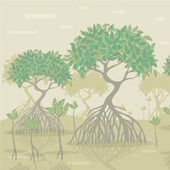
Mangrove forests are also known as ‘Tidal Forests’, ‘Coastal Woodlands’, ‘Walking Forest in the Sea’, ‘Root of the Sea’ and ‘Oceanic Rain Forests’.
Mangroves are the only terrestrial plants that can tolerate direct immersion in sea water. They can survive in saline conditions due to their specialised salt-filtering roots and salt-excreting leaves.
The mangrove cover in India is 4,740 sq.km, which is 0.14 per cent of country’s total geographical area.
Indian mangroves represent 2.7 percent of the world’s mangroves.
Only 0.03% of the world’s water is available as liquid freshwater.
Wetlands of international importance are known as Ramsar sites, and there are six Ramsar regions.
India has around 26 wetlands of international importance, as defined by the Ramsar Convention for the conservation and sustainable utilisation of wetlands.
The 2nd of February each year is celebrated as World Wetlands Day, marking the date of the adoption of the Convention on Wetlands on 2 February 1971.
Indian Rivers
- The Indian rivers are divided into the Himalayan rivers and the Peninsular rivers.
- Most of the Himalayan rivers are perennial, which means that they have water throughout the year. These rivers receive water from rain, as well snow mountains.
- A large number of the Peninsular rivers are seasonal, and they depend on rainwater. During the dry season, the large rivers have reduced flow of water.
- The Peninsular rivers have shorter and shallower courses as compared to the Himalayan rivers. Most of the peninsular rivers originate in the Western Ghats and flow towards the Bay of Bengal.
Indian Rivers: The Himalaya Rivers
- The Indus , the Ganga and the Brahamaputra are the major Himalayan rivers, and originate from the north of the Himalayan mountain range.
- The Indus river rises in Tibet, near lake Mansarowar. It covers the states of Jammu and Kashmir, Himachal Pradesh, and the Punjab.
Indian Rivers: The Ganga Rivers
- The river Ganga or also known as the Ganges, is fed by the Gangotri glacier and joined by the Alaknanda at Devprayag in Uttarkhand.
- It originates in Gangotri glacier as Bhagirathi and as it is joined by Alaknanda at Devprayag, it turns into Ganga.
- It covers the states of Uttarakhand, Uttar Pradesh, Bihar and West Bengal.
Indian Rivers: The Brahmaputra Rivers
- The Brahmaputra river rises in Tibet , east of the Mansarowar lake.
- It is slightly longer than the Indus, and most of it lies outside India.
- During the rainy season, the river overflows its banks and is marked by huge deposits of silt on its bed, which causes the river bed to rise, and it also shifts its channel frequently.
Indian Rivers: The Peninsular Rivers
- As mentioned earlier the Peninsular rivers have shorter and shallower courses as compared to the Himalayan rivers.
- Most of the major Peninsular rivers such as the Mahanadi, the Godavari, the Krishna and the Kaveri flow eastwards and drain into the Bay of Bengal.
- The Narmada and the Tapi are the rivers that flow west and make estuaries.
- The Narmada basin covers parts of Madhya Pradesh and Gujarat.
- The Tapi basin covers part of Madhya Pradesh, Gujarat, and Maharashtra.
- The Godavari is the largest Peninsular river. Its drainage basin is also the largest among the peninsular rivers, as it covers Maharashtra, Odisha and Andhra Pradesh.
- The Mahanadi basin covers Maharashtra, Chhattisgarh, Jharkhand and Odisha.
- The Krishna basin covers Maharashtra, Karnataka, and Andhra Pradesh.
- The Kaveri rises in the Brahmagri range of the Western Ghats and drains into the Bay of Bengal. It also makes the second biggest waterfall in India. It is known as Sivasundram.